OHLA presents one of the most innovative railway digitization projects in Europe
OHLA presents one of the most innovative railway digitization projects in Europe
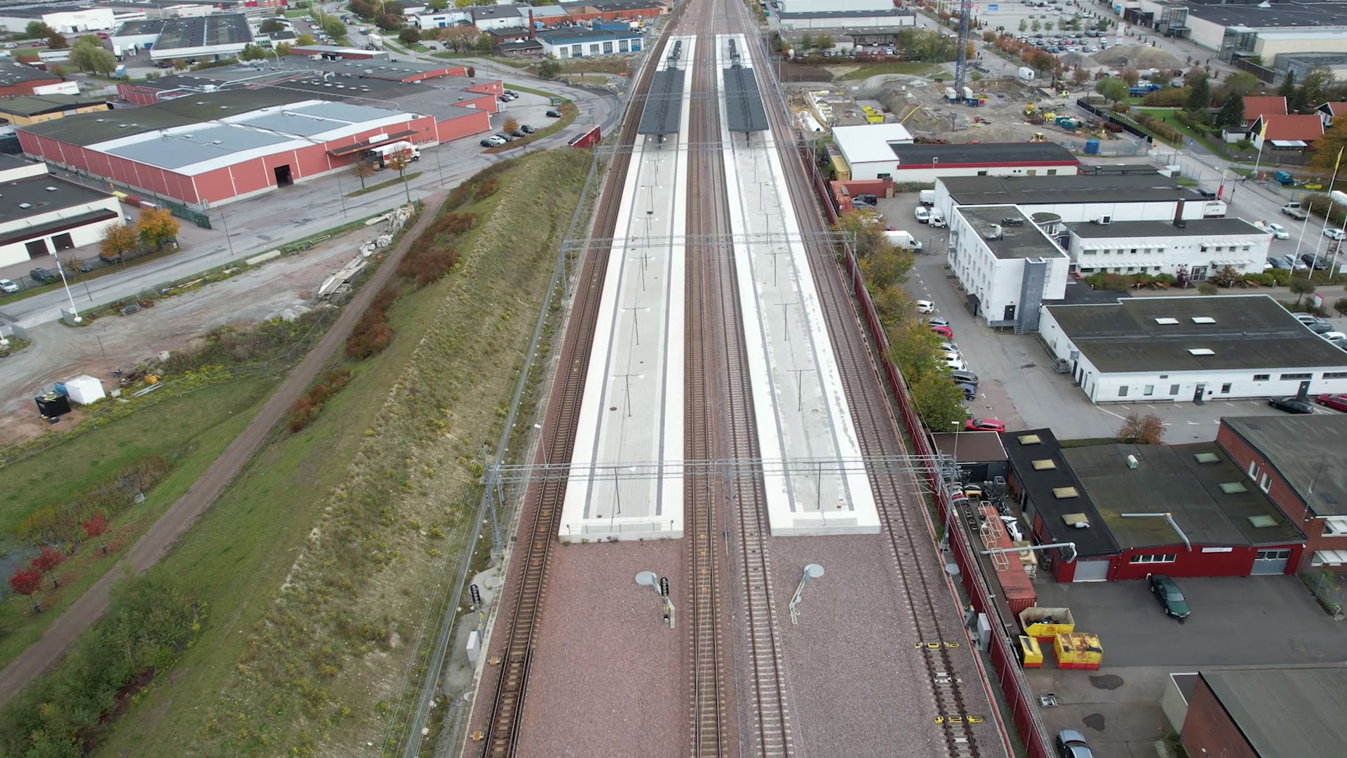
Burlov station, Sweden.
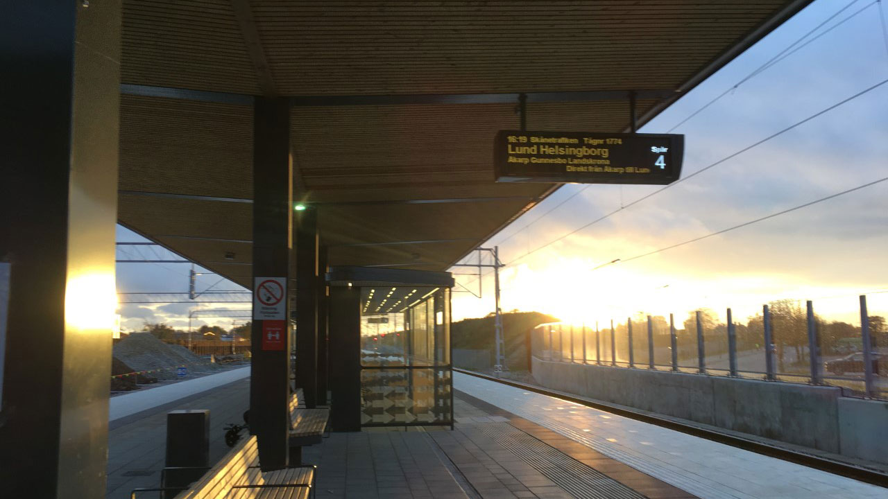
Burlov station canopies, Sweden.
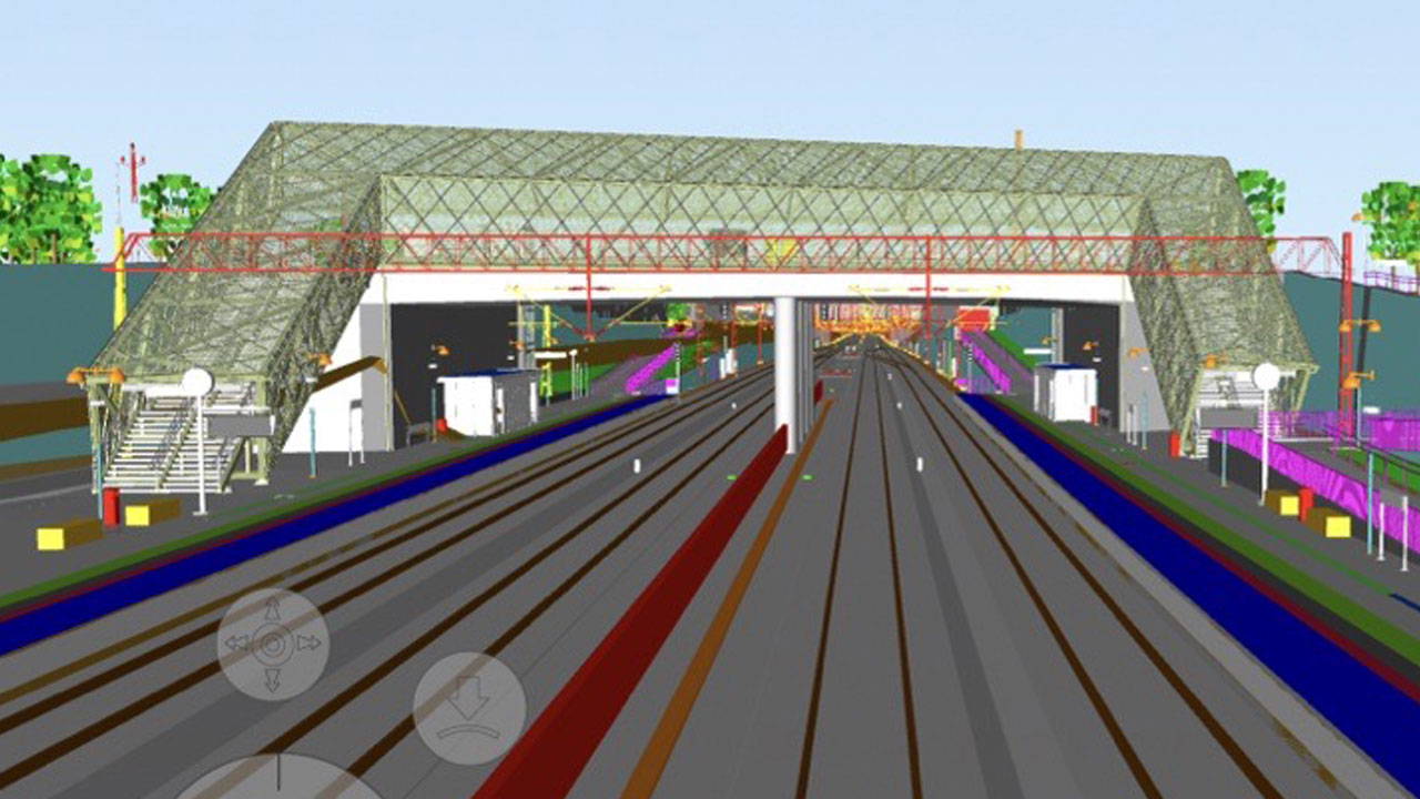
Digital twins.
OHLA has unveiled at the Esri Spain conference, the largest geospatial technology event in Europe, the details of the Lund-Arlöv project (Sweden), where it has carried out one of the most advanced digitization projects in Europe.
The project, an innovative example of the combined use of BIM methodology, geographic information systems (GIS) and drones, is aimed at improving one of Sweden’s busiest rail routes, with a daily traffic of 450 trains and approximately 60,000 passengers. Upon completion of the works, this capacity will be increased to 650 trains and 80,000 passengers per day.
"Projects such as Lund-Arlöv are an excellent example of the potential of digitalization in construction and more specifically the symbiosis between BIM, GIS and drones"
Manuel Carpintero, BIM Manager at OHLA, and creator of the application, detailed in his presentation the role played by the digital twins, a virtual representation of the real world generated from BIM models, drone images and geographic information systems (GIS), in the construction of this railway section.
Utilizamos cookies propias y de terceros para mejorar nuestros servicios y mostrarle publicidad relacionada con sus preferencias media. Puede cambiar la configuración u obtener más información en nuestra "Política de Cookies".
This website uses cookies to improve your experience while you navigate through the website. Out of these, the cookies that are categorized as necessary are stored on your browser as they are essential for the working of basic functionalities of the website. We also use third-party cookies that help us analyze and understand how you use this website. These cookies will be stored in your browser only with your consent. You also have the option to opt-out of these cookies. But opting out of some of these cookies may affect your browsing experience.