
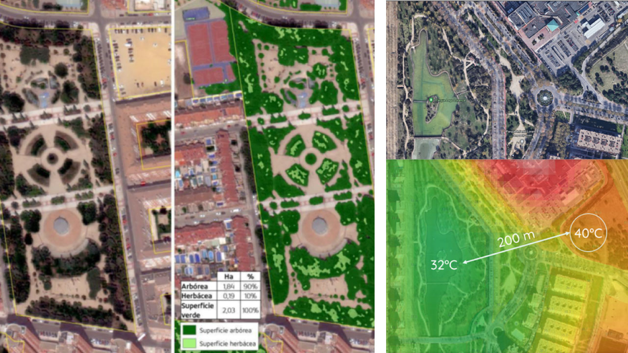
Right: Surface temperature distribution, which allows us to identify the existence of the urban heat island phenomenon, as well as to assess and design measures to improve the urban ecosystem.
OHLA, through Ingesan, the leading subsidiary of its Services business line, has implemented in Spain Coordinal and VerSat, two digital design and proprietary solutions. Specifically, the company already uses both tools in contracts linked to its line of activity of urban services applied to the management of green areas and is analyzing extending it to other projects.
Coordinal, a SaaS (Software as a Service) platform, is developed on GIS technology for the integrated management of green areas and landscaped spaces in urban and peri-urban environments. maintenance, adaptation and improvement of green areas and natural spaces in the city of Albacete and its districts.
The OHLA subsidiary has also designed the VerSat platform, a pioneering R&D project in Spain that applies very high-resolution satellite images to detect areas for improvement and optimize the management of urban green spaces.