
OHLA implements Coordinal and VerSat in Spain, two digital solutions for better urban climate management
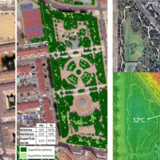
Left: Automatic characterization of tree and herbaceous surface using artificial intelligence techniques on satellite images of very high spatial resolution (15 cm/pixel) of